We have been working steadily on our USA landmarks and symbols unit study. This is a unit that doesn't lend itself as well to pictures since I have pulled it together using history resources I have on hand. The kids each have a notebook and we've been adding to it steadily. Funny enough, LD has said he LOVES history and has been really into this unit. That amazes me a bit because it has been less project-oriented than many of our units have tended to be (and involves a lot more writing on his part).
I read a review on Wright on Time at Almost Homeschoolers and decided this might fit in well with our unit study.
We've done quite a bit with US geography.
landmark and symbols cards (note--our blog has moved. This link takes you to our new location... the cards are still free, but are hosted over at homeschoolden.com. See you there!! ~Liesl) I made last summer regularly and lay them out on a big map we have.
We talked about the Statue of Liberty and did a couple crafts:
And drew our own fireworks based on this project from Art Projects for Kids.
That's it for now!
You may be interested in these related posts:
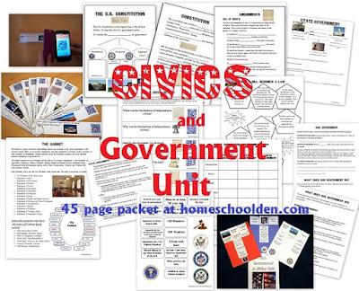
Last year: Civics and Government Unit We went into much more depth about the US again. Not only did we go over some of the well-known American landmarks and symbols, but we went over some basic facts about the US government. We have a new 40-page US Civics and Government Unit available which includes civics cards, pages about the 3 branches of government, sorting cards about the different responsibilities of the legislative, judicial and executive branches and much more.
 |
| We used a couple lessons from Art Projects for Kids - Desert Landscape and How to Draw a Cactus. |
 |
| They had colored lights, but the scene was still pretty, if not entirely natural |
 |
| Okay--so back to our unit--we did more reading and worksheets, sang lots of US songs (Yankee Doodle, My Country Tis of Thee and the like). |
landmark and symbols cards (note--our blog has moved. This link takes you to our new location... the cards are still free, but are hosted over at homeschoolden.com. See you there!! ~Liesl) I made last summer regularly and lay them out on a big map we have.
We talked about the Statue of Liberty and did a couple crafts:
That's it for now!
You may be interested in these related posts:
Last year: Civics and Government Unit We went into much more depth about the US again. Not only did we go over some of the well-known American landmarks and symbols, but we went over some basic facts about the US government. We have a new 40-page US Civics and Government Unit available which includes civics cards, pages about the 3 branches of government, sorting cards about the different responsibilities of the legislative, judicial and executive branches and much more.
We also have a World Facts Packet which has students identify the world's largest countries, the countries with the highest populations, the longest river in the world, the highest mountain, the largest desert, etc. This packet also has a U.S. Facts pages (the largest/smallest states, highest mountain, largest cities, major rivers and lakes, etc.)
This packet goes over some basic world facts. Do they know…
- What are the four largest countries? (Russia, Canada, the U.S.A., China)
- What countries have the most people? (China, India, the U.S.A.)
- What are the world’s largest cities? (Tokyo, Jakarta, Seoul)
- Which countries have the longest life expectancy? (Monaco, Macau, Japan)
- What are the major religions?
- Famous world landmarks
- What is the U.S. capital? Washington, D.C.
- What is the smallest state? Rhode Island
- Biggest state? Alaska
- What is the name of the tallest mountain in the U.S.? Mt. McKinley
- What is the longest river? Mississippi River
- There is also a sheet so the kids can locate some geographic features of the US: the larger rivers, the oceans, Gulf of Mexico, and the Great Lakes
If you do a lot of Montessori activities with your students, you might check out this post: Various Free Montessori Cards.
See you soon over at our other location: homeschoolden.com or over at our Homeschool Den Facebook Page. ~Liesl


No comments:
Post a Comment