Showing posts with label Geography. Show all posts

Friday, February 10, 2012

American West Unit: Geography and the Louisiana Purchase

Our next topic was the Louisiana Purchase. Prior to 1803, the United States territory went only as far as the Mississippi River. Napoleon Bonaparte, the ruler of France, needed money for his wars in Europe and sold the Louisiana Territory to the U.S. for $15 million (3 cents an acre!).  This nearly doubled the size of the United States.
We've been using a map that shows the Louisiana Purchase and Lewis and Clark's expedition route to learn move about American geography. In addition to learning the Fifty States song we've been learning the five Great Lakes (the Great Lakes have their H*O*M*E*S* in Canada and the United States... Lakes Huron, Ontario, Michigan, Erie and Superior), a few of the major rivers, and the mountain ranges.

We have been using a pin map to help us learn some of these locations.

While we've used pin maps for a long time, I saw this wonderful idea of using a cork board and taping the map on top over at We Don't Need No Education. It was quick and easy to set this activity up!


If you want to make your own pin map work to go along with your studies of the Louisiana Purchase and Lewis and Clark you can download the labels I made here. I used the National Geographic map of the Lewis and Clark expedition.

Our Move: On another note, next week, the week of Valentine's Day, our blog will be joining the Parent's team over at Parents.com/blog.  I'll have a link from this address to get you there.  I hope you'll check in on us there!  We've done some great experiments and will be sharing more about our geography, history and preschool activities in the next couple of weeks.

Friday, September 9, 2011

Making Globes

One of the Montessori materials we do not have is a sandpaper globe or a globe that shows just the 7 continents in their "proper" Montessori colors. That's partly because we have a cute globe already (one that lights up and has various world animals on it). But for some reason we got a hankering to make our own globes.

What better way to learn where the oceans are located than to make our own globe?! We worked on it a bit every few days.

Paper mache is really easy to do -- the "glue" we use is 1 cup flour and 1 cup water (mixed vigorously). Then we add 4 cups of boiling hot water (and Mom mixes).  Let the mixture cool and then dip strips of paper into the mixture and spread smoothly.

We bought three big balls (for less than $3 each) from Target to use as our base.
Then we painted it all blue.
A few days later I painted the basic continents so that the kids knew where to place the glue and colored sand.
 
Although DD and LD know the song, it's now ED's turn to learn the 7 continent song (to the tune of "Frère Jacques"). This is how we sing the song:
   Europe, Asia    (Are you sleeping)
   A-fri-ca    (Are you sleeping)
   North America, South America (Brother John, Brother John)
   Then there is Antarctica (Morning bells are ringing)
   Don't forget Australia (Morning bells are ringing)
   7 continents, 7 continents (Ding, ding, dong, Ding, ding, dong)


Tuesday, July 26, 2011

US Landmarks and Symbols -- free 3-part Montessori cards

I am busy planning and getting ready for this next year.  I couldn't find exactly what I was looking for and so made these 3-part cards for our upcoming unit study on America. Cards include landmarks such as the Statue of Liberty, the Grand Canyon, Yellowstone, the White House, Mount Rushmore and more.

UPDATE: You can download the free US Landmarks and Symbols cards at our new location.  This link will take you there.

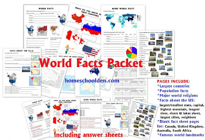
We also have world landmark cards and matching pages in our World Facts Packet

http://homeschoolden.com/2015/07/27/world-facts-packet/


We also have a new 45-page Civics and Government Packet that you may be interested in. It covers the 3 branches of government and includes civics cards, notebook pages and much more.


Monday, July 25, 2011

Let's Learn about the World

When we start back into our school year LD and DD are going to learn some basic facts about the world in which we live --
the largest continent-Asia
the largest country-Russia
the largest ocean-Pacific
the largest desert-Sahara
the tallest mountain-Mt. Everest
the longest river-the Nile has been long thought to be the longest river, but an expedition in 2000 found the Amazon River to be 64 miles longer.
world population (6 billion+).

If you are interested you can find our Let's Learn about the World sheet here.


Saturday, July 23, 2011

This is the United States--Unit Study

American  Landmarks, Symbols, Basic Facts

We are going to study some basic facts and symbols of the United States with this unit study.  Things like
US geography (rivers, mountains, time zones)
famous landmarks
American patriotic songs
the US flag
the Liberty Bell
the Statue of Liberty,
the Great Seal etc. etc.


 Here are the topics we'll be covering over a two or three week period (or so) in this introduction to the U.S. I typed it up for myself, but you can  click here to see that sheet. I have a lot of wonderful history resources from my years of teaching a 7-10 year old class called "American History for Kids."  We'll be doing tons of activities and readings selected from my numerous resources (which I obviously can't share because they are copyright protected). And another reason why I'm so excited is because my best friend here is going to do this same unit and we hope to do lots of trips together. Hooray!

In a couple of days I'll share the fact sheet I made about the world.


I'll be sharing my US Landmarks (Montessori type) 3-part cards on July 26th.
(Left--Space Needle, Seattle, WA) Update, here's the link!!

US Landmarks and Symbols — free 3-part Montessori cards (over at our new location, homeschoolden.com

http://homeschoolden.com/2011/07/26/us-landmarks-and-symbols-free-3-part-montessori-cards/
I love this cute rhyme/song to learn the 50 states. It's called 50 States That Rhyme.  The kids loved their South America countries and capitals song (Rock the Capitals) and learned so much that I'm inclined to give this a go as well!

By the way, for those of you who live in the US, I noticed that Target has lots of things in their dollar bin area (in our area at least) that we'll find especially useful this year -- US Presidents and world landmarks, for example.  

You might also be interested in our World Facts Packet
http://homeschoolden.com/2015/07/27/world-facts-packet/

This goes over some basic world facts.  Do they know…
  • What are the four largest countries? (Russia, Canada, the U.S.A., China)
  • What countries have the most people? (China, India, the U.S.A.)
  • What are the world’s largest cities? (Tokyo, Jakarta, Seoul)
  • Which countries have the longest life expectancy? (Monaco, Macau, Japan)
  • What are the major religions?
Since we live in the U.S., I also had the kids go over some basic facts about America.
  • What is the U.S. capital? Washington, D.C.
  • What is the smallest state? Rhode Island
  • Biggest state? Alaska
  • What is the name of the tallest mountain in the U.S.? Mt. McKinley
  • What is the longest river? Mississippi River
  • There is also a sheet so the kids can locate some geographic features of the US: the larger rivers, the oceans, Gulf of Mexico, and the Great Lakes

Thursday, May 26, 2011

World Music Class: Games and Music of Mexico and South America

Since my kids are learning a bit about the Mayans, Aztecs and Incas we decided to jump to South America with our world music class.  We are enjoying music, geography and games from Mexico and South America.

Here's what we're covered with our friends the past couple of weeks:

*We all sing hello and each child chooses a movement for the rest of the group to follow.

*I pull out the guitar and we sing two or three folk songs/kids songs together.  This session we're doing On Top of Old Smokey, On Top of Spaghetti, and Yankee Doodle. That's because we're learning la Cucaracha on the glockenspiel and it is a protest song similar in vein to Yankee Doodle.

*We have a rhythm sheet I made and we clap out the rhythm for la Cucaracha

*Then we all take a turn playing la Cucaracha on the glockenspiel (I have the notes written out, but not the musical notation. We haven't covered that yet.)

*We always cover a bit of geography in our class--and start off with the continent song (to the tune of Frere Jacques)
Europe, Asia, Af-ri-ca
North America, South America
Then there is Antarctica
Don't forget Australia
Seven continents, Seven continents

(See how to make your own continent pin map here.)
The kids all know it now, but I still like to review it each class. Also, the kids from the three-year old music class usually join in for the first part of class before they lose interest and go play, so ED is starting to know the continents too!

We are learning the countries and capitals of South America with the help of this video.  The kids try to sing along as best they can.  I have the capitals and countries written out, but the kids are only five so don't read well. We just fumble along best we can!


Caracas, Venezuela
Bogata, Columbia
Quito Ecuador
Lima, Peru
La Paz, Bolivia
Asuncion, Paraguay
Santiago, Chile
Buenos Aires, Argentina
Montevideo, Uruguay
Brasilia, Brazil

I got the South American country flags (free) from Montessori Materials.

*South American cookie map project: Instead of the same ole pin map, we made a South America cookie (one per child) with five country flags (just five from the song), chocolate chip Andes Mountains and one long, blue piece of Amazon spaghetti for the river!


South America Cookie Pin Map
 *We did the Mexican Hat Dance and the kids practiced dancing with their heels touching the floor. They did an impressive job. Even our 3-yr old friend managed to do it!

*We have been acting out the story of Don Gato (a Mexican folk tale); we've been acting it out with instruments. Next week I may use the book Señor Don Gato : a traditional song, which I borrowed from the library.

*We also might sing the song (sheet music here) and the lyrics in English and Spanish can be found at kididdles.com or by searching the web. A youtube version (with cute video) can be found here.

*We played a cute Mexican circle game called A Guanchilopostle where one child is in the middle, the rest hold hands and circle round him/her. On the chorus, the one in the middle dances while the others clap. Then he/she closes his/her eyes to choose another to be in the middle. Lyrics, MP3 recording can be found at mamalisa.com.

*The Toad and Mosquitoes -- El Sapo Game (Mexico)
The mosquitoes hold hands and circle the toad. They change directions every verse. When the song comes to an end, the toad tries to catch one of the mosquitoes.

Have a wonderful weekend!

Thursday, March 31, 2011

Geography: Europe board game

We've done a lot with geography of Europe this semester. That's in part because three of our unit studies have focused on Europe -- our world music class, the Middle Ages unit and our fairy tale unit.  I ordered this game back in February, but with the flu and pneumonia descending upon us we never got to it.  We've had a blast with it the past week or so.

Here's the set up. Each player has wooden slots and gets 10 cards which they set in one by one.

There are three discard piles and one pick up pile.

On a player's turn they can pick up a card from any of those four piles.

The official rules say you can't move the cards around. That would be too long and hard for my kids (5 and 7), so the kids move the cards around freely.

The object is to travel through Europe going from country to country in 10 days (10 slots).  You can connect by plane if the countries are the same color. You can also take a ship if that country touches the appropriate water body (the Mediterranean, Baltic or Atlantic Ocean). You have to begin and end in a country (not on a ship or in a plane).


LD won the game and is showing how he made the connections by car, ship and plane.
LD started in Italy took a ship to Portugal, traveled by car to Spain,  took a plane to Austria, took another plane to Belgium and took a ship through the Baltic Sea to Latvia.

Wednesday, March 2, 2011

World Music : Europe

For the first time in months, we had our music classes. We took a long break because of the holidays, sickness and house problems. It was so wonderful to catch up with our friends again.  We are continuing on with our studies of Europe and the music of Europe.  First, we reviewed the seven continents (to the tune of Frere Jacques). 
Europe, Asia, A-fri-caa,
North America
South America
Then there is Antarctica
Don't forget Australia
Seven continents, Seven Continents
A great pin map of the seven continents is located here.


We located five countries of Europe with the pin map and with the wooden puzzle. The kids located Germany, Austria, Britain, France and Italy.


We danced the Heel and Toe Polka -- a circle dance from the Alps. The last class, we had examined a German bierstein  and listened to German drinking songs, pretending to tap cups, etc.

We sang Frere Jacques in French and also sang a German children's song that helps teach the numbers from 1 to 10 in German:
Eins, zwei Polizei
drei, vier, Offizier
funf, sechs, alte Hex
sieben, Acht gute Nacht
neun, zehn, auf Wiedersehen.


We listened to examples of Alpine instruments (including the cow bell!) and sang along with a yodeling song.

We played a French children's game that was like follow the leader.

Then we started to learn a bit about Mozart.  We learned that Mozart went on tour throughout Europe as a young child and traveled to Germany, Austria, Britain, Italy and France (those countries we identified in the beginning of class).

We listened to some excerpts of Mozart's pieces. If you need some large pictures of famous composers, you can find some beautiful printouts here. (The size of a 8X11 paper)
You can find small composer cards here.
My printouts aren't the best because I ran out of printer ink, but that gives you an idea.


Finally, we made some soft pretzels (which are said to have originated perhaps in Germany).  Erica from Confessions of a Homeschooler has a wonderful recipe which we used.  Thank you, Erica!!


Sunday, November 28, 2010

How to Make a Pin Map of Europe

We are heading off to Europe in our world music class this week and to get ready for that, I made a pin map of Europe.  I'll explain how I made mine in case someone else finds it useful.

Step 1: I printed off a blank map of Europe from freeusandworldmaps.com.  I also printed off the labeled Europe map from that same website as a control. I laminated these two maps.


Step 2: I cut out a piece of plastic for the base (so the pins don't go through all of the foam), 4 pieces of foam and placed the laminated map on the top. I used the sticky side of the foam to hold the plastic base and the map in place.


Step 3:  I cut out a piece of contact paper so that it was about an inch and a half wider than my foam/map pile.


Step 4: I put the contact paper across the bottom and under the laminated map on top.


Step 5: I used clear packing tape (which I find more durable and stronger than the contact paper) and place about a half-inch of tape across the map's borders and wrapped it around to the back.


Step 6: My laminator broke on its way across the ocean, so I used an iron (heated up and then cooled) to quickly move down the laminating sheets and seal them. This is not as good as a laminating machine, but will do for now until I replace my old one.

European country flag and labels: I used the smaller version of the flags of Europe free to download at Montessori Materials


 Step 7: I cut out the flag/labels and then put a push pin through the left hand side.  Then I used packing tape and covered both the front, the pin and the back of the flag.


Step 8: I trimmed the tape around the edges.


 Here's the finished product once again:

I've also made pin maps of the continents, Asia and of the world biomes (scroll through the "geography" entries on the left sidebar if you're interested in seeing those).

You might be interested in this free Europe printable map, which is over at my new location homeschoolden.com.

Europe – Countries and Flag Maps Free Printable

http://homeschoolden.com/2016/04/14/europe-countries-and-flag-maps-free-printable/
 See you again soon over at homeschoolden.com! Be sure to visit our store for more of our packets - in science, history, math, spelling and more!! 

http://homeschoolden.com/store/


Happy Homeschooling!  ~Liesl